
Published by
Published on
January 16, 2026


New capability in Cosmic Frog brings the same optimization power that supply chain teams use for network design to route territory structures.
Supply chain teams are pulling ahead not just by running their networks better — they're designing them better, and then rapidly redesigning them when conditions shift. And now, a new feature available from Optilogic extends this advantage to territory design.
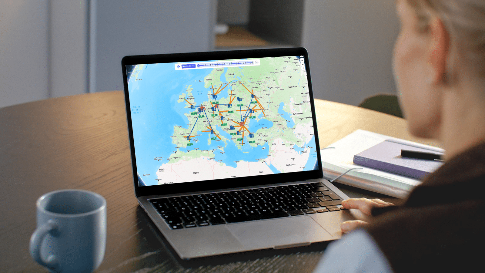
Territory Planning in Cosmic Frog enables you to design delivery territories and routes — and adjust your strategy on the fly when order volume shifts with seasonality, disruption, or market changes. All while providing full visibility into the trade-offs between cost efficiency and streamlined, pragmatic operations.
Traditional routing optimization asks one question: "What's the lowest-cost solution?" The answer might save money on paper but cost you in practice.
There may be opportunities to leverage different transportation providers to take advantage of volume discounts as part of pre-negotiated contracts that don’t have hard constraints on territories. Or drivers who consistently serve the same neighborhoods develop expertise you can't model. They know which businesses accept deliveries at the back dock, and which streets become parking nightmares after 3:00 p.m. This accumulated knowledge translates directly to faster deliveries and fewer failed attempts. Organizations that ignore this reality optimize for a number while missing the opportunity to turn delivery into a competitive advantage.
Territory Planning automatically clusters customers into geographic territories and keeps routes and drivers operating within defined boundaries. The result: you can finally see what operational structure actually costs, and where optimized territories can recover efficiency without sacrificing the benefits of driver familiarity and service consistency.
In the Territory Planning Settings table, specify your requirements: number of territories, minimum and maximum constraints on delivery/pickup locations and quantities per territory. The optimizer evaluates thousands of configurations to find the best possible implementation—you see the trade-offs; you make the strategic call.
Run transportation optimization in High Precision mode, and Territory Planning simultaneously minimizes transportation costs while creating well-defined geographic territories, balancing multiple objectives that would be impossible to optimize manually.
The real power emerges when you compare scenarios. Run an unconstrained optimization (pure cost minimization), your current manual territory design, and multiple optimized territory configurations side by side. The result: confident decisions backed by quantified trade-offs.
Optimized territories consistently achieve lower total transportation costs than manually designed boundaries—while still respecting all territory constraints. This comparison reveals exactly what you're trading: the cost of operational structure versus the benefits of that structure.
One leading retailer is putting Territory Planning to work in their weekly delivery operations.
"Territory Planning lets us design territories that deliver the highest service levels to our customers while minimizing routing costs. We're not just optimizing routes—we're optimizing which carriers to work with in each territory and refreshing our route designs weekly. It's changed how we think about delivery as a competitive advantage." - Leading Retailer
Visibility into trade-offs comes from two new output tables that Territory Planning generates alongside all standard transportation optimization results:
Territory Planning Summary: Aggregate KPIs per territory—delivery locations, routes, total distance, and time. Compare territory sizes, identify workload imbalances, and export for presentations.
Territory Assignment Summary: Detailed customer-to-territory assignments with coordinates for map visualization. Analyze geographic cohesion, export for operational implementation, and compare assignments across scenarios.
Predictable service windows become a competitive advantage. When territories are served on defined schedules, you can promise specific delivery windows at the point of purchase, while managing costs and time efficiencies—driving higher conversion rates and reducing "where's my order?" support volume. In a market where delivery experience determines brand loyalty, this visibility becomes a growth lever.
Driver expertise compounds into cost savings and retention. Drivers who own their territory become faster and more effective through accumulated local knowledge. Fewer failed delivery attempts. Lower cost-per-stop. And drivers who prefer consistent territories are drivers who stay—in a tight labor market, that retention matters.
Agility when conditions change. When demand patterns shift or you enter new markets, territories can be redesigned in hours rather than weeks—optimizing for current conditions instead of relying on manual zone definitions created years ago.
Many organizations already use territories—they just haven't optimized them. Someone years ago drew lines on a map based on intuition. Those boundaries may have made sense once, but demand patterns shift and customer locations change.
Territory Planning applies the same optimization power you use for network design—now for route structures. You keep the operational benefits of territories while recovering efficiency that manual designs leave on the table. And when conditions change next quarter—or next week—you can refresh the analysis without starting from scratch.
Territory Planning is available now in Cosmic Frog for all users. A template model in the Resource Library demonstrates the feature with preconfigured scenarios comparing manual territories, optimized territories, and unconstrained routes.
See a Quick Demo of Territory Planning
Watch Neeru Bhopal, Director of Product Management at Optilogic, demonstrate how Territory Planning creates efficient, geographically coherent delivery zones.
About Optilogic
Optilogic is an AI-first supply chain design company that revolutionizes decision-making by transforming modeling from a three-month project into one-day breakthroughs. We combine AI, mathematical optimization, and simulation to help enterprises shift from data preparation to strategic network design decisions. Our platform empowers teams to answer critical what-if questions in real-time and optimize complex supply chain networks, while our Solutions team provides hands-on expertise to ensure rapid success. We give supply chain professionals superpowers by automating tedious work so they can focus on strategic thinking that creates business value. Learn more at optilogic.com.
For detailed configuration guidance, visit the Help Center documentation. Have questions? Reach out to your Customer Success Manager or contact support@optilogic.com.
New capability in Cosmic Frog brings the same optimization power that supply chain teams use for network design to route territory structures.
Supply chain teams are pulling ahead not just by running their networks better — they're designing them better, and then rapidly redesigning them when conditions shift. And now, a new feature available from Optilogic extends this advantage to territory design.
Territory Planning in Cosmic Frog enables you to design delivery territories and routes — and adjust your strategy on the fly when order volume shifts with seasonality, disruption, or market changes. All while providing full visibility into the trade-offs between cost efficiency and streamlined, pragmatic operations.
Traditional routing optimization asks one question: "What's the lowest-cost solution?" The answer might save money on paper but cost you in practice.
There may be opportunities to leverage different transportation providers to take advantage of volume discounts as part of pre-negotiated contracts that don’t have hard constraints on territories. Or drivers who consistently serve the same neighborhoods develop expertise you can't model. They know which businesses accept deliveries at the back dock, and which streets become parking nightmares after 3:00 p.m. This accumulated knowledge translates directly to faster deliveries and fewer failed attempts. Organizations that ignore this reality optimize for a number while missing the opportunity to turn delivery into a competitive advantage.
Territory Planning automatically clusters customers into geographic territories and keeps routes and drivers operating within defined boundaries. The result: you can finally see what operational structure actually costs, and where optimized territories can recover efficiency without sacrificing the benefits of driver familiarity and service consistency.
In the Territory Planning Settings table, specify your requirements: number of territories, minimum and maximum constraints on delivery/pickup locations and quantities per territory. The optimizer evaluates thousands of configurations to find the best possible implementation—you see the trade-offs; you make the strategic call.
Run transportation optimization in High Precision mode, and Territory Planning simultaneously minimizes transportation costs while creating well-defined geographic territories, balancing multiple objectives that would be impossible to optimize manually.
The real power emerges when you compare scenarios. Run an unconstrained optimization (pure cost minimization), your current manual territory design, and multiple optimized territory configurations side by side. The result: confident decisions backed by quantified trade-offs.
Optimized territories consistently achieve lower total transportation costs than manually designed boundaries—while still respecting all territory constraints. This comparison reveals exactly what you're trading: the cost of operational structure versus the benefits of that structure.
One leading retailer is putting Territory Planning to work in their weekly delivery operations.
"Territory Planning lets us design territories that deliver the highest service levels to our customers while minimizing routing costs. We're not just optimizing routes—we're optimizing which carriers to work with in each territory and refreshing our route designs weekly. It's changed how we think about delivery as a competitive advantage." - Leading Retailer
Visibility into trade-offs comes from two new output tables that Territory Planning generates alongside all standard transportation optimization results:
Territory Planning Summary: Aggregate KPIs per territory—delivery locations, routes, total distance, and time. Compare territory sizes, identify workload imbalances, and export for presentations.
Territory Assignment Summary: Detailed customer-to-territory assignments with coordinates for map visualization. Analyze geographic cohesion, export for operational implementation, and compare assignments across scenarios.
Predictable service windows become a competitive advantage. When territories are served on defined schedules, you can promise specific delivery windows at the point of purchase, while managing costs and time efficiencies—driving higher conversion rates and reducing "where's my order?" support volume. In a market where delivery experience determines brand loyalty, this visibility becomes a growth lever.
Driver expertise compounds into cost savings and retention. Drivers who own their territory become faster and more effective through accumulated local knowledge. Fewer failed delivery attempts. Lower cost-per-stop. And drivers who prefer consistent territories are drivers who stay—in a tight labor market, that retention matters.
Agility when conditions change. When demand patterns shift or you enter new markets, territories can be redesigned in hours rather than weeks—optimizing for current conditions instead of relying on manual zone definitions created years ago.
Many organizations already use territories—they just haven't optimized them. Someone years ago drew lines on a map based on intuition. Those boundaries may have made sense once, but demand patterns shift and customer locations change.
Territory Planning applies the same optimization power you use for network design—now for route structures. You keep the operational benefits of territories while recovering efficiency that manual designs leave on the table. And when conditions change next quarter—or next week—you can refresh the analysis without starting from scratch.
Territory Planning is available now in Cosmic Frog for all users. A template model in the Resource Library demonstrates the feature with preconfigured scenarios comparing manual territories, optimized territories, and unconstrained routes.
See a Quick Demo of Territory Planning
Watch Neeru Bhopal, Director of Product Management at Optilogic, demonstrate how Territory Planning creates efficient, geographically coherent delivery zones.
About Optilogic
Optilogic is an AI-first supply chain design company that revolutionizes decision-making by transforming modeling from a three-month project into one-day breakthroughs. We combine AI, mathematical optimization, and simulation to help enterprises shift from data preparation to strategic network design decisions. Our platform empowers teams to answer critical what-if questions in real-time and optimize complex supply chain networks, while our Solutions team provides hands-on expertise to ensure rapid success. We give supply chain professionals superpowers by automating tedious work so they can focus on strategic thinking that creates business value. Learn more at optilogic.com.
For detailed configuration guidance, visit the Help Center documentation. Have questions? Reach out to your Customer Success Manager or contact support@optilogic.com.
Fill out the form to unlock the full content
.jpg)


.png)
.png)
.png)